
Risk360
Climate intelligence that becomes an operational decision.
What will fail, what to prioritise and where to act — before the extreme event arrives.
Explore Risk360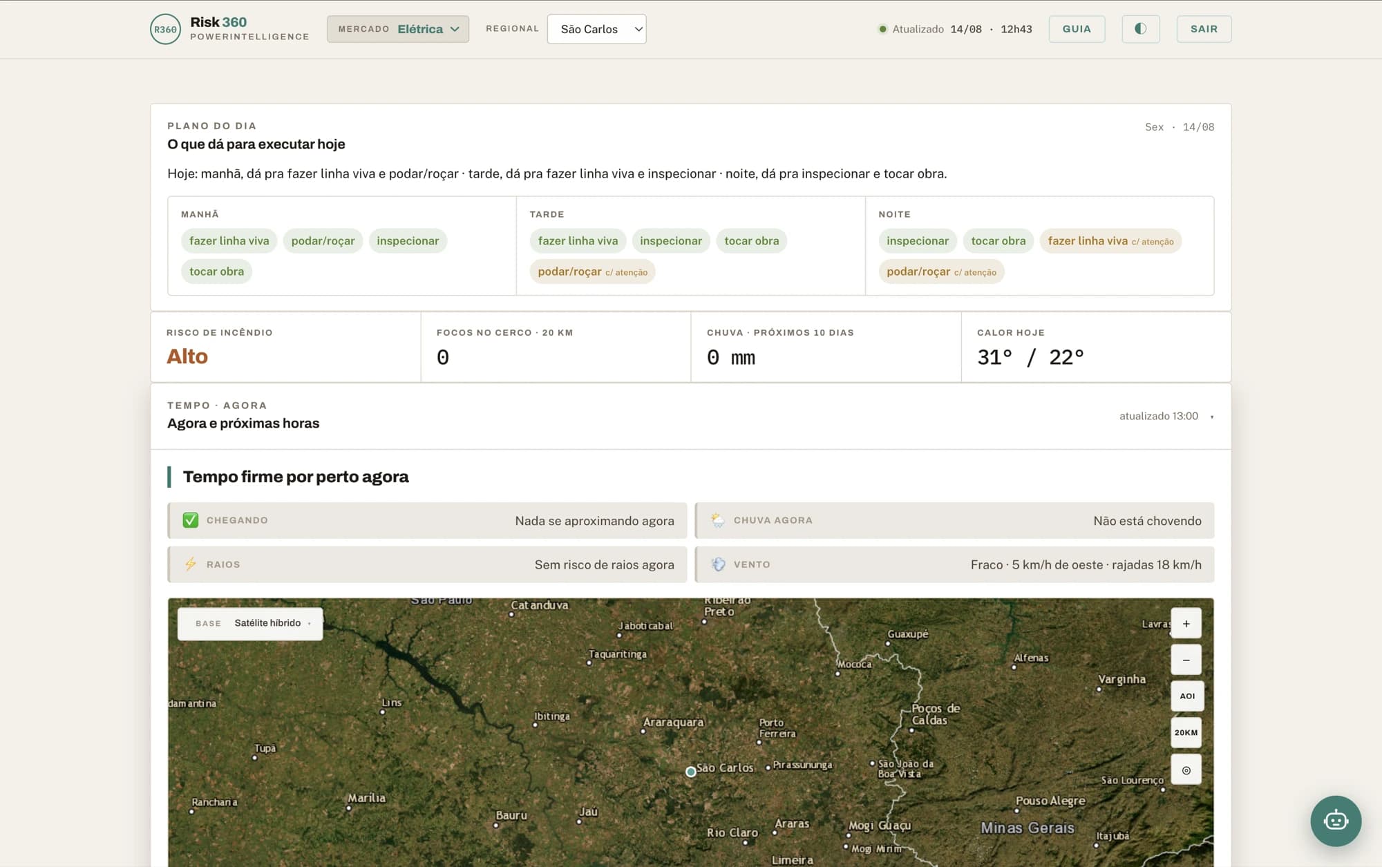
Three platforms and the engines that feed them. Each solves one time horizon, and all share the same architecture: a deterministic engine that classifies, AI that explains.
Climate intelligence that becomes an operational decision.
What will fail, what to prioritise and where to act — before the extreme event arrives.
Explore Risk360Long-term climate governance, with numbers that survive an audit.
Where to build, what to reinforce, what inaction costs — with the climate variable entering every phase of the decision, not just the report at the end.
Explore Climate Edge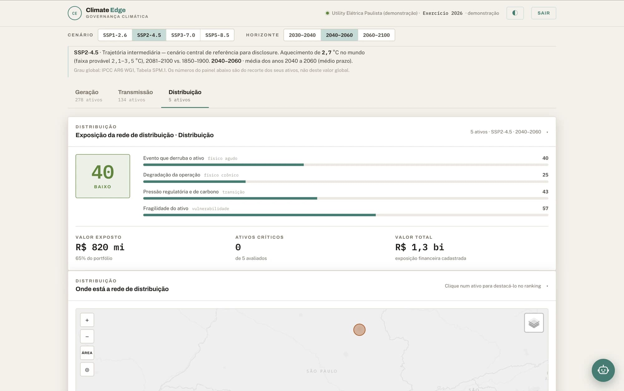
Ask your map. In your language.
Advanced spatial analysis in plain language, over the data your operation already has.
Explore MapsAI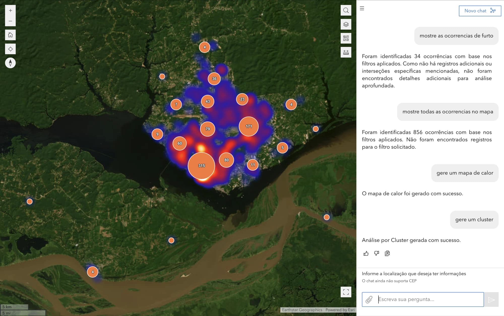
One specialist per sector. Not a generic chatbot.
The agents run inside all three platforms — and they also go into your systems and your team’s WhatsApp, as a copilot or as an autopilot.
The question each one answers
Power utilities
“Can we do live-line work tomorrow morning?”
Agriculture
“What is the best spraying window this week?”
Water and sanitation
“Can I clear confined-space entry this afternoon?”
Telecom
“Which site loses power first if the front arrives?”
Infrastructure
“Any hotspots near the right-of-way?”
Civil defence
“Which flood scenario does this rainfall trigger?”
Engines
They run inside Risk360 and are also licensed on their own, over an API, for teams that already have a dashboard.
Storm nowcasting, a high-resolution 10-day forecast and a 6-month seasonal trend — from one engine.
Three horizons under one contract: the storm minute by minute, the ten days on grids down to 2 km, and the anomaly for the next six months.
Wildfire risk on a 10-day horizon, with spread remodelled every 20 minutes.
Detection, risk and spread cross-referenced against your registry: the alarm carries the asset name, the distance in metres and an estimate of the hours until the fire reaches it.
How you buy it
The full dashboard, with your sector’s views, operated by us in the cloud. The shortest path: it starts running with no infrastructure project on your side.
Forecasting, wildfire risk, hydrology and climate projection delivered over an API, with the variable dictionary generated from the services themselves. For teams that already have a dashboard and want the model, not the interface.
The climate risk agents answer from inside what your company already uses: your dashboard, your ERP, your field team’s WhatsApp. You are not giving the team one more interface — you are putting the specialist inside the one they already have.
Copilot or autopilot, depending on how much the operation wants to delegate. The agent arrives with the sector’s vocabulary and access to our models, without anyone having to open our platform.
GIS services and Maps as a Service: georeferenced layers, maps and components published for your team to build your own product on top. You build; the geospatial foundation is ours.
When the contract requires the data to stay in the building, MapsAI runs inside the client’s security perimeter. It is the only product that works this way today.
Risk360 and Climate Edge depend on models and data that run on our side, and promising on-premise for them would be a promise the first technical meeting would undo.
Not every platform fits all five, and on-premise is the most restricted case: today, MapsAI only. The shape is settled during scoping, before the contract, alongside the targets and the sources.
If it involves climate, territory and data, it is our ground. The conversation starts from a real slice of your operation — not from a deck.