
Technology
From science to software in production.
São Tomás builds proprietary technology end to end: our own climate and geospatial models, enterprise platforms and artificial intelligence agents — developed and maintained by a senior team combining climate science, remote sensing and software engineering with decades of experience.
What we build
Proprietary models
High-resolution weather forecasting (Weather Trends), wildfire risk and spread (Wildfire Sentinel, Fire Path), hydrology and geo-hydrological risk (GeoGuard), and long-term climate projection.
Artificial intelligence agents
Orchestrators and specialist agents that reason, call tools and produce answers and actions under human supervision (human-in-the-loop), with guardrails and audit trails.
Enterprise platforms and integrations
Delivered as a complete platform, an API (DaaS), agents over API and channel (AaaS), GIS services and Maps as a Service; integrating with ERPs, SCADA, OMS, ArcGIS, Cell Broadcast and alerting systems.
Bespoke projects
Building data, geospatial intelligence and AI solutions for the client’s specific challenge, from design through assisted operation.
How we build
AI explains, the engine decides
In regulated domains, risk classification is deterministic, versioned and auditable; the AI interprets and guides, never replaces the method.
Security and governance by default
LGPD compliance, data hosted in Brazil and full traceability of decisions. For those who cannot let the data leave the building, MapsAI operates inside the client’s security perimeter.
World-class cloud
We are a Google Cloud Partner; our platforms run on cloud infrastructure with data hosted in Brazil.
Technology partners
We do not rebuild what already exists and works. The geospatial foundation, the sensors and the cloud come from the people who do it best — and that is what our models run on.
 EsriGlobal leader in geographic information systems and creator of ArcGIS, the geospatial foundation the platforms run on.
 Imagem GeosistemasEsri’s official distributor in Brazil, for geospatial technology, data and training.
 ZukkGeographic intelligence: GIS, Geo AI and bespoke development on the ArcGIS platform.
 Leica GeosystemsPrecision sensing and measurement — the field data that underpins the asset registry.
 Google CloudWe are a Google Cloud Partner: the platforms run on the cloud, with data hosted in Brazil.
Platforms
One client, two horizons
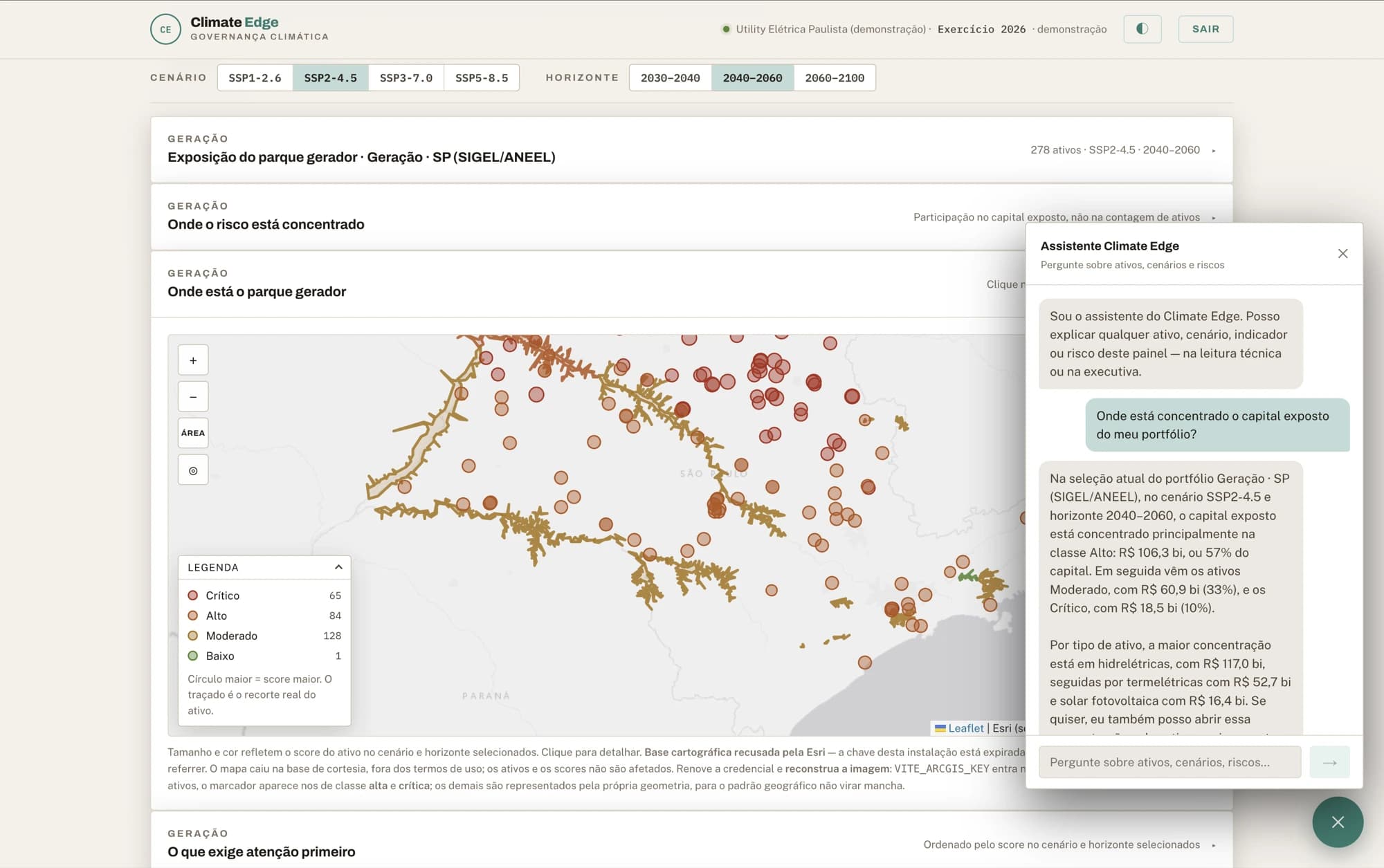
The board decides with Climate Edge; the operation acts with Risk360. MapsAI is the map they both consult.
Bring us your challenge
If it involves climate, territory and data, it is our ground. The conversation starts from a real slice of your operation — not from a deck.